Fired hurricane hunter says Americans could see 'more damage and more loss of life' with NOAA layoffs
Source: The Independent
Sunday 16 March 2025 09:46 EDT
Dr. Andrew Hazelton is one of the nation’s Hurricane Hunters. He was part of the crews that would fly deep into powerful hurricanes as they churned in the ocean, all to collect data to help forecasters improve predictions on the storm’s power and direction. But, he was among the first rounds of layoffs at the National Oceanic and Atmospheric Association.
He said his job loss - and the thousands that have followed - are making Americans less safe. “Because you could see the forecast improvements that we’ve come to count on or rely on could be reversed,” he told The Independent. “And, that would lead to more damage, potentially, and more loss of life. And, that’s not what we want to see.”
President Donald Trump and Elon Musk, though his Department of Government Efficiency, have sought to trim the federal budget. They are looking at shrinking the workforce and have pushed for cuts across the federal government, including NOAA. About 800 agency workers were laid off in February with another 1,000 let go last week.
Advocates have blasted the cuts at NOAA. They have pointed to how little the agency costs each taxpayer per day, when compared to the return. They note how the agency provides much of the data that weather forecasting is based on. They say losing people hurts their work, which could make people less safe when severe weather is on the horizon. "So it is, like, cutting off your nose to spite your face. Which seems a bit counterintuitive if your goal is really to serve the American people,” a former agency official previously told The Independent.
Read more: https://www.the-independent.com/news/science/hurricane-watch-noaa-layoff-doge-b2715281.html
What most "lay" people don't realize (although those in the field like mets, climate scientists, etc., or hobbyists like me know this), is that they ( "Hurricane Hunters" ) are releasing what are known as dropsondes - special sensors that measure altitude, wind speeds temperature, pressure,and humidity (throughout the descent as it falls), and that data is returned to generate plots to show what the conditions are from the drop point at the plane's current altitude, down to the water surface.

They may release 15 or so of these (more or less depending on the size of the storm) along various points within the cyclone - including along the outer rain bands and around/in the eye. That data then gets plotted to create some pretty cool charts/graphs.
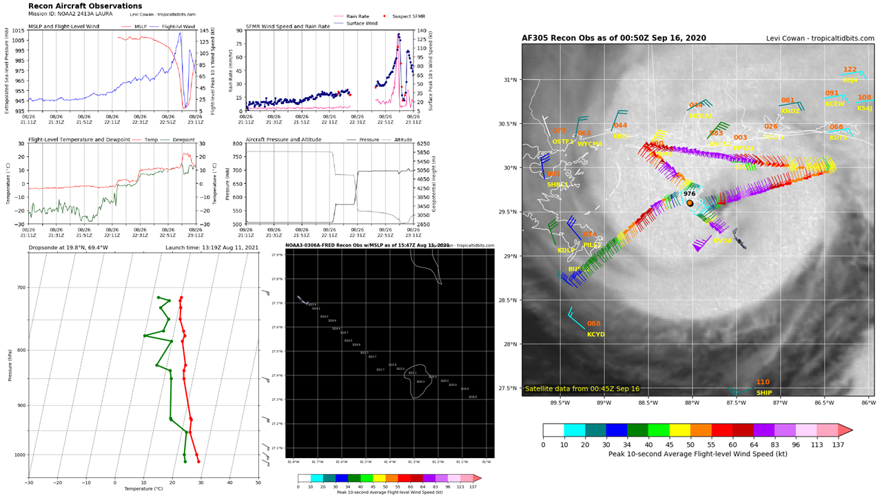
NOAA and the U.S. Air Force rotate flights into these storms. This is a good site describing what they are looking at/for (and not just looking out the window at the "stadium effect" of a hurricane eye) - https://www.carstensweather.com/post/a-somewhat-comprehensive-guide-to-recon-data
 = new reply since forum marked as read
Highlight:
NoneDon't highlight anything
5 newestHighlight 5 most recent replies
= new reply since forum marked as read
Highlight:
NoneDon't highlight anything
5 newestHighlight 5 most recent replies

Grokenstein
(5,966 posts)
Buddyzbuddy
(772 posts)