Volume 63 Number 4, July/August 2010
by Arlen F. Chase, Diane Z. Chase, and John F. Weishampel
Airborne sensors reveal a vast Maya landscape
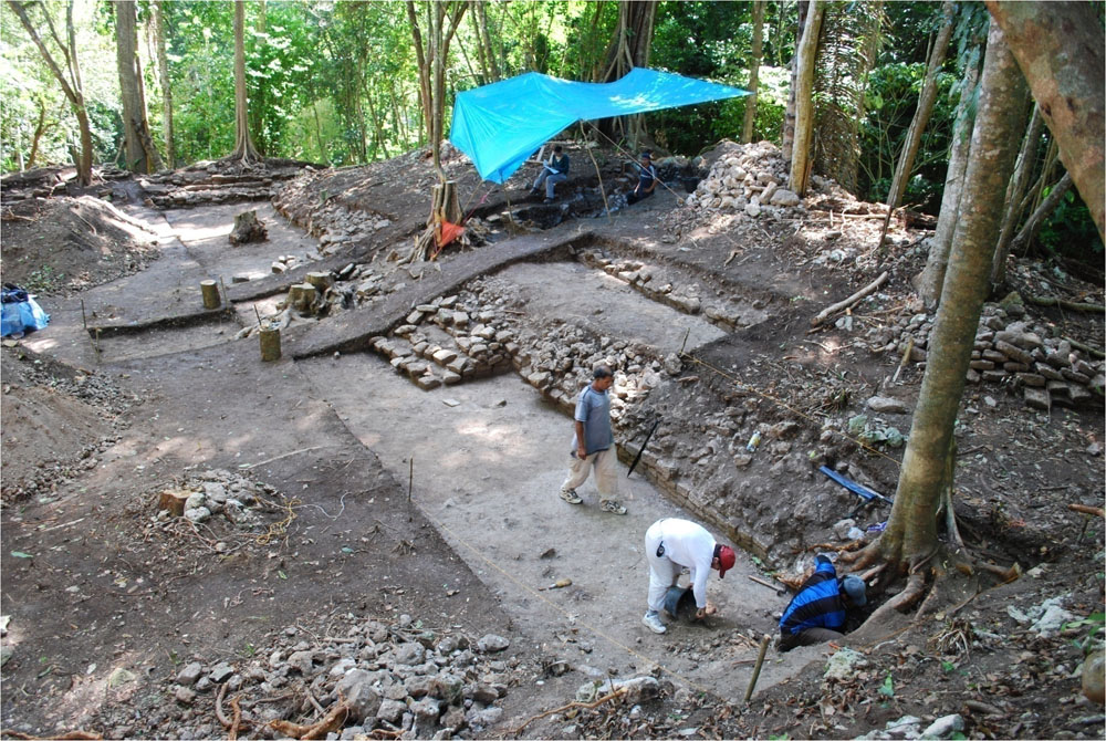
Caracol has been studied and excavated for 25 years, but just a few weeks of LiDAR work created a detailed map of 80 square miles of the site—nearly eight times the area that had been previously mapped from the ground. (Courtesy Arlen Chase)
Even when one is almost directly on top of them, many Maya sites are impossible to see. In the jungle, small palms and brush can spring to 14 feet high in a year, filling the space between towering cedar, mahogany, ramon, and ceiba trees. When we can find large Maya sites, we cannot easily map them because it is expensive and labor-intensive. Even modern electronic distance meters have limited functionality; if we can't see through the trees, neither can they. So we cut paths with machetes, scramble through thick underbrush, and wonder what we might be missing. The ability to see through this dense, steamy jungle has long been the dream of Maya archaeologists.
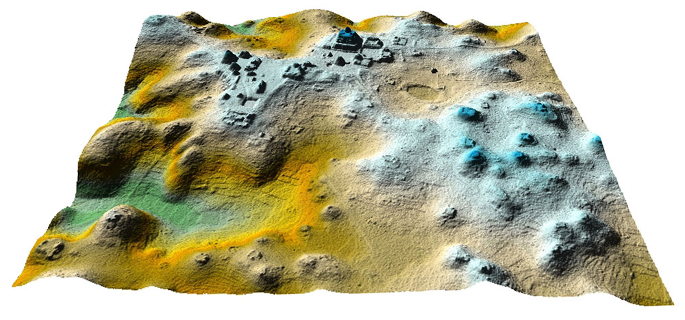
Airborne laser-scanning technology, called LiDAR, provides a 3-D map of part of the Maya city at Caracol in Belize. LiDAR cuts through the jungle to reveal the hidden features beneath--a revolution in the study of ancient Maya landscapes. (Courtesy Arlen Chase)
These difficulties have led us to underestimate the accomplishments and ingenuity of the ancient Maya. There is little agreement among archaeologists over just how big some Maya cities were, how many people lived in them, or how intensively their residents modified the landscape. It often appears that sites in more easily studied areas of the world—plains, sparse forests, or areas cleared in modern times—are larger and more complex than their tropical forest counterparts. Does this impression reflect the inability of ancient humans to create large, sustainable settlements in the tropics, or is it the result of incomplete investigations, hampered by the complications of working in a rainforest?
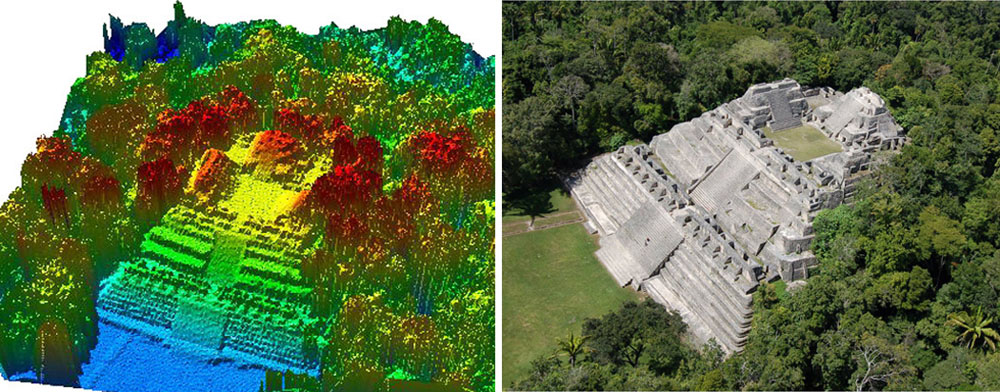
A LiDAR image of the Caana complex at the heart of Caracol, at left, shows the tree canopy surrounding a 140-foot-tall building (in an aerial photo at right). The lasers also penetrate the jungle to reveal structures hidden by that overgrowth. (Courtesy Arlen Chase)
These difficulties have led us to underestimate the accomplishments and ingenuity of the ancient Maya. There is little agreement among archaeologists over just how big some Maya cities were, how many people lived in them, or how intensively their residents modified the landscape. It often appears that sites in more easily studied areas of the world—plains, sparse forests, or areas cleared in modern times—are larger and more complex than their tropical forest counterparts. Does this impression reflect the inability of ancient humans to create large, sustainable settlements in the tropics, or is it the result of incomplete investigations, hampered by the complications of working in a rainforest?
More:
https://archive.archaeology.org/1007/etc/caracol.html

 = new reply since forum marked as read